
Teaching material · Digital download
Equal Earth Geography Worksheets, New UN World Map 2026 Teaching Pack, Blank Map
€7.90
Final price. No VAT charged under § 19 UStG (small business).
- Download right after payment
- Secure payment via Stripe
Included files (5)
- CartoClear_EqualEarth_TeachingPack_en.zip · 5.5 MB
- CartoClear_EqualEarth_TeachingPack_de.zip · 5.5 MB
- CartoClear_EqualEarth_TeachingPack_fr.zip · 5.6 MB
- CartoClear_EqualEarth_TeachingPack_it.zip · 5.5 MB
- CartoClear_EqualEarth_TeachingPack_es.zip · 5.5 MB
Description
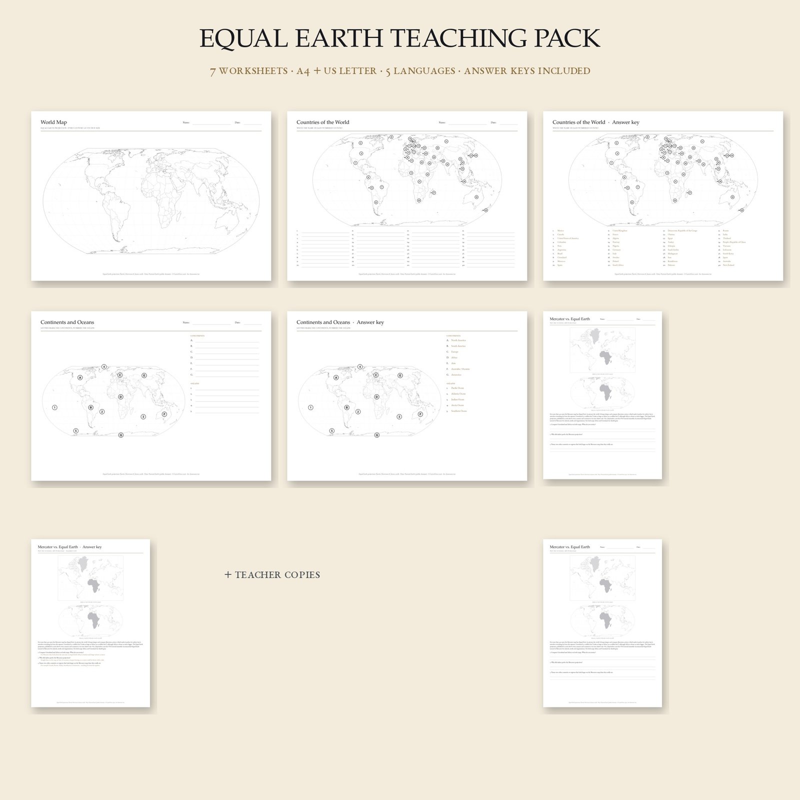
Teach the map the world is switching to. On 4 September 2026 the UN General Assembly voted 164 to 1 for the 'Correct the Map' resolution, recommending the equal-area Equal Earth projection in place of Mercator, which shows Greenland as large as Africa although Africa is about 14 times bigger. This pack brings that change into the classroom with seven ready-to-print worksheets:
1. Blank world map (Equal Earth, country borders, name and date line)
2. Countries of the world: 40 numbered countries to name, with leader lines where countries are small
3. Answer key for sheet 2
4. Continents and oceans: letters and numbers to fill in
5. Answer key for sheet 4
6. Mercator vs. Equal Earth: both maps with Greenland and Africa shaded, a short explainer text and three questions
7. Teacher's copy of sheet 6 with model answers
DIGITAL DOWNLOAD ONLY
No printed material is shipped.
INCLUDED IN YOUR PURCHASE
- 5 ZIP downloads, one per language: English, German, French, Italian, Spanish. Country and continent names, instructions and the lesson text are fully translated.
- Each ZIP: 7 worksheets × 2 page formats (A4 and US Letter) = 14 PDF files at 300 dpi, black-and-white, ink-friendly.
- Suitable for ages 9 and up, primary and lower secondary geography, homeschool and language classes (use another language's pack for vocabulary work).
HOW TO PRINT
Print at 100% / Actual Size on A4 or Letter paper. The blank map also works as a template for your own tasks.
LICENCE & DATA
Licensed for use in your own classroom, school or home; you may print as many copies as you need for your students. The files may not be resold, shared with other teachers or uploaded to platforms. Projection: Equal Earth (Šavrič, Patterson & Jenny, 2018). Country shapes and names: Natural Earth (public domain), de-facto boundaries. Design: CartoClear.
MORE FROM THE EQUAL EARTH SERIES
- Blank map template (SVG, PDF, PNG): https://cartoclear.com/en/karte/equal-earth-leere-weltkarte-vorlage/
- Light edition with country borders: https://cartoclear.com/en/karte/equal-earth-weltkarte-mit-laendergrenzen/
- Mercator vs Equal Earth comparison poster: https://cartoclear.com/en/karte/mercator-vs-equal-earth-vergleichsposter/
- Visited Countries colour-in map: https://cartoclear.com/en/karte/bereiste-laender-weltkarte-zum-ausmalen/
DEUTSCH
Unterrichtspaket zur neuen UN-Weltkarte: Am 4. September 2026 hat die UN-Generalversammlung mit 164 zu 1 Stimmen die Resolution „Correct the Map“ angenommen und empfiehlt die flächentreue Equal-Earth-Projektion anstelle von Mercator. Sieben Arbeitsblätter: stumme Weltkarte, 40 nummerierte Länder (+ Lösung), Kontinente und Ozeane (+ Lösung), Mercator vs. Equal Earth mit Erklärtext und drei Aufgaben (+ Lehrerexemplar). 5 ZIPs, je Sprache 14 PDFs (A4 und US Letter, 300 dpi, schwarz-weiß). Ab ca. 9 Jahren, für Grundschule, Sekundarstufe I und Homeschooling. Lizenz: Nutzung im eigenen Unterricht, beliebig viele Kopien für die eigenen Schüler; keine Weitergabe oder Weiterverkauf der Dateien. Digitaler Download, kein gedrucktes Material.